


Aerial Tagging System for Beluga Whale
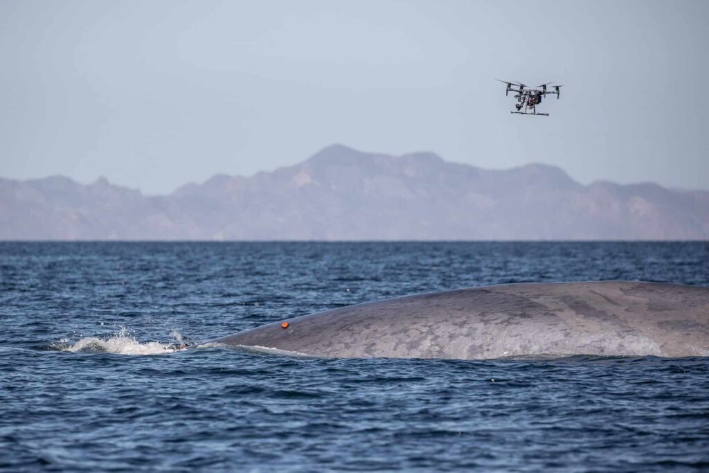
Department of Fisheries and Oceans (DFO) has partnered with STAR Lab at the University of Manitoba to develop a UAV system to implant LIMPET tracking tags to Narwhal and Beluga whales in the Canadian Arctic. The aim of the project is to improve on traditional attachment methods which are limited by range and accuracy, as well as can put undue stress on the whale. The team is aiming to create a partially automated fused sensor system and begin testing in Summer 2026.
Image credit: Christian Miller and the Snotbot team from 2022.
Research Student: Daniel Elias
Reaction Wheel Design
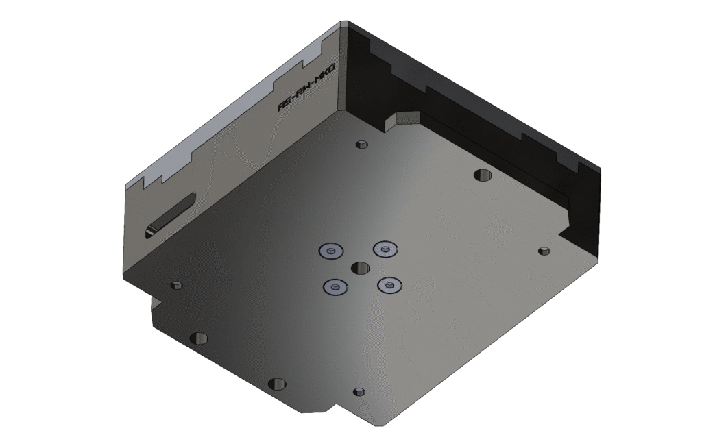
This is a metal additively manufactured reaction wheel flywheel for the ArcticSat CubeSat. This reaction wheel will enable ArcticSat to change its attitude for data collection during orbit.
Research Student: Ricky Gill
Arctic Community Connectivity for Equity, Sustainability, and Service [Access]
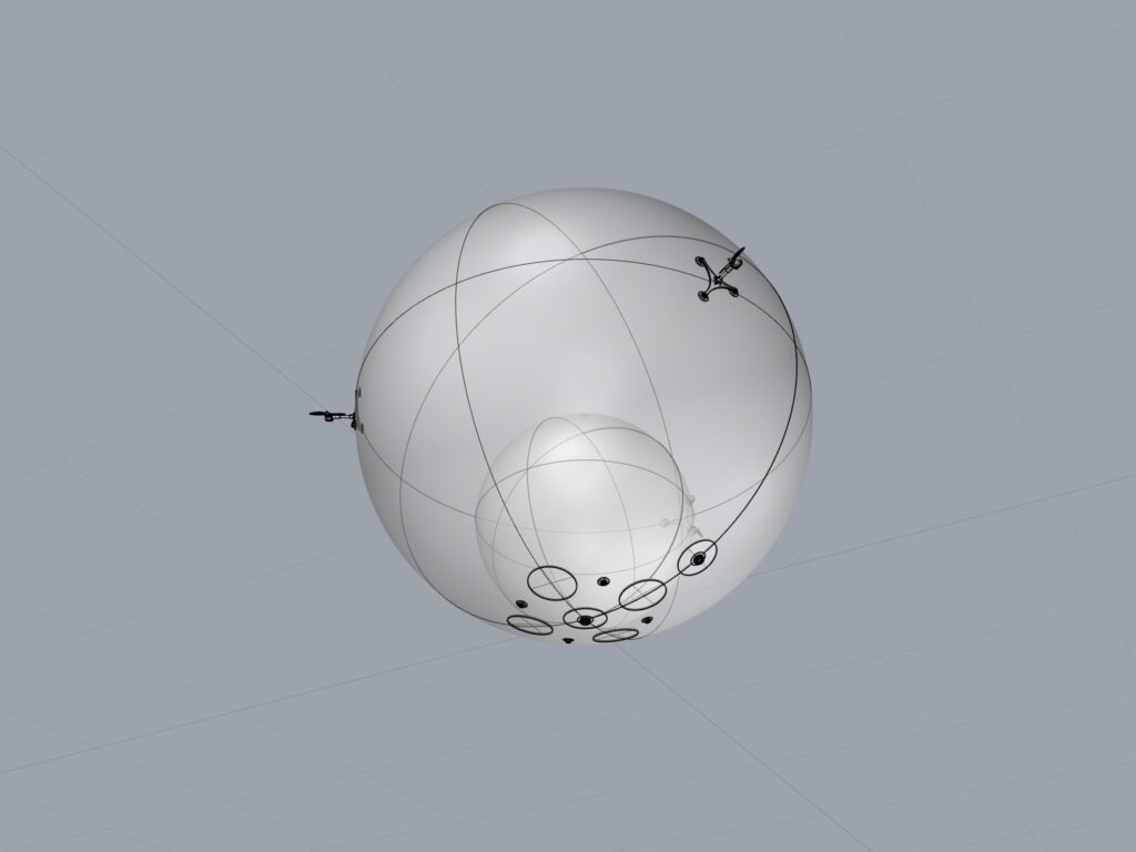
The ACCESS project addresses the disparity in communication services between Northern Canadian communities and the rest of Canada.
This research explores a novel solution: an airship functioning as mobile satellite communications hub, designed to enhance data sharing and connectivity in these remote Arctic regions.
Research Student: Daniel Asante [Altitude Control] & Mana Zandvakili [Station-Keeping]
1U Thruster Module
Small satellites—particularly CubeSats—traditionally operate without propulsion due to strict mass, volume, and cost constraints. As the space environment becomes increasingly congested, however, even small spacecraft are now expected to execute collision avoidance (COLA) maneuvers and demonstrate responsible end-of-life deorbiting to comply with emerging space-stewardship regulations.
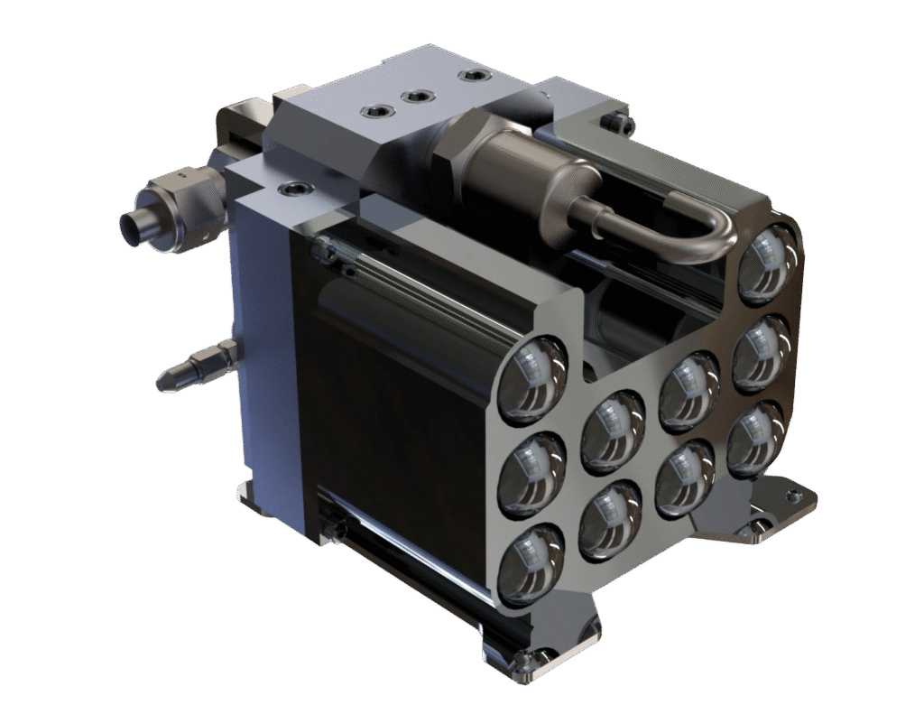
To address this need, the research focuses on developing a low-cost, compact, and manufacturable cold gas thruster tailored for CubeSat platforms.
This is a 1U thruster module and would be used on the LISSA 6U Cubesat for Collison Avoidance (COLA) maneuvers.
Research Student: Elham Baneshie
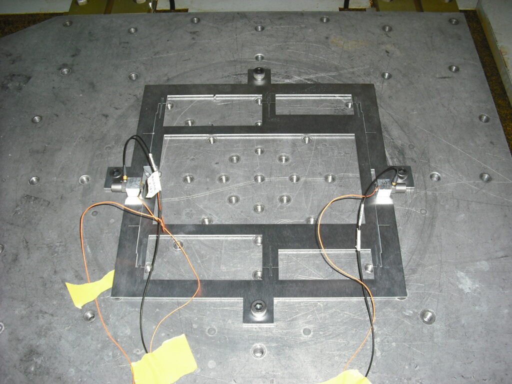
Low-Cost Structural Scale Modelling for Space Systems
This research focuses on creating cheaper, faster, and more accessible ways to test how spacecraft and tiny sensors respond to rocket launches. Normally, these tests are expensive, risky, and happen just before launch, which makes fixing problems difficult. To solve this, I have developed a method using low-cost scale models (smaller or larger versions of real designs). Changing the size of models can make them easier, faster, and cheaper to make. It can also help people use them by making heavy designs light, or fragile designs strong.
The key to my work is the quasi-transfer function (QTF). These are math shortcuts that predict what a full-scale structure will do based on what a scale model does. Simulations and preliminary testing show that QTFs can accurately predict the resonant frequencies a structure. Ongoing work looks to further support this with more testing, and to expand QTFs to cover more structural responses to dynamic loads.
Image Caption: A 34-times scale MEMS accelerometer model set up for vibration testing.
Research Student: Andrew Bowman
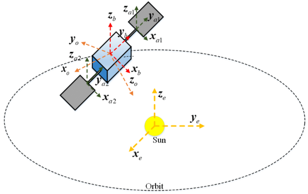
Predictive control of underactuated spacecraft
This research leverages the disturbance environment a CubeSat experiences to improve pointing performance during specific portions of the orbit. As satellites get cheaper and more people gain access to space, optimizations in the attitude control system will allow for better science with a lower cost. Some of these optimizations may be reducing number of axes that the satellite has control authority over. A satellite may experience atmospheric drag, gravity gradient, and solar pressure. I am researching how a satellite could monitor these disturbances over multiple orbits, and then begin to predict the disturbances during the next orbit. It will then work with these disturbance torques to improve attitude control during critical parts of the mission.
In addition, I am also researching how an underactuated satellite can use this predictive map of the environment to better plan attitude slew events. For instance, if the satellite wants to accurately point at the Earth 2 orbits from now, what can it do now to produce the best pointing stability when it gets there?
Image credit: Lei Jin and Yingjie Li (mdpi)
Research Student: Brendan O’Doherty
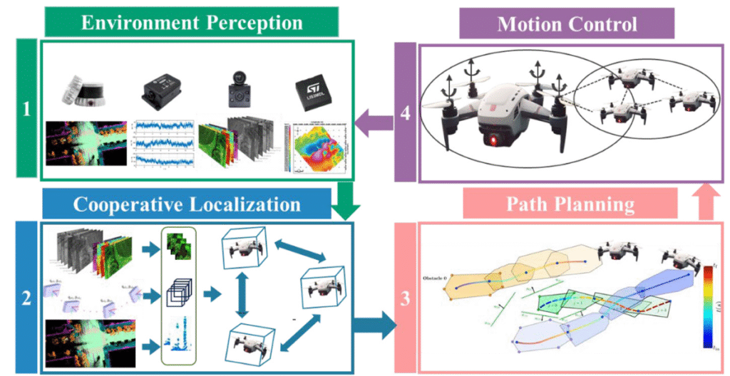
Development of Cooperative Localization Algorithms for Multi UAV Swarms
This research focuses on improving how groups of autonomous robots such as drones operating in remote or harsh environments determine where they are and how to move safely when GPS or communication is unreliable. I investigate cooperative localization methods, where multiple robots share partial information, combine their sensor data, and build a more confident understanding of their surroundings together than any one robot could alone. By developing and testing algorithms that integrate control theory, probabilistic estimation, and learning-based strategies, this work aims to create more resilient multi-robot systems capable of navigating, coordinating, and adapting in real time. Ultimately, the goal is to advance the core foundations of cooperative autonomy so these systems can be deployed reliably in real-world applications such as environmental monitoring, search-and-rescue, and emerging aerospace platforms.
Image Credit: Image from: The development of distributed cooperative localization algorithms for Multi-UAV systems in the past decade by Zhaoyu Zhang, Nan Li, Gongmin Yan, Weiqi Li
Research Student: Evan Evaniuk
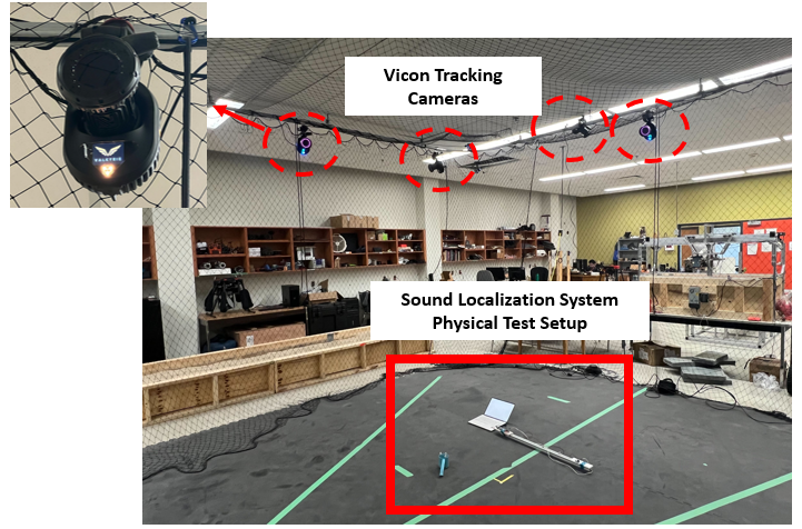
Advanced Sound Localization System for Optimized Drone-Based Target Tracking
For years, technologies applied in agriculture have attracted considerable attention and interest with the primary purpose of improving crop management efficiency. This has led to the development of automated systems and robotic machines, such as GPS-guided tractors and drones, all designed for autonomous industrial farming. They are typically designed for preplanned or controlled crop fields and may fail in more complex, unpredictable conditions. To address this gap, my research is being inspired by the most advanced autonomous systems in nature: predators and prey. For example, a hunter can detect and track the motion of prey in the dark or through dense foliage by relying on a sense that modern robotics has often neglected: hearing. Building on this idea, my work explores how drones can autonomously identify and follow targets using sound signals, developing a more adaptable and resilient sensing method for dynamic agricultural settings. My research aims to advance drone technology and explore its practical applications, including in Indigenous agricultural practices. Indigenous agriculture plays an important role in the global agricultural ecosystem, where wild rice (Manoomin), as a top-10 plant-based protein, holds cultural significance for Indigenous communities and represents a significant economic opportunity. As the impact of bird pests on the wild rice crop has become a concern in recent years, it is important to find a way to control the birds to improve crop yield, which can also be a practical application in real-world scenarios. My research introduces an innovative and advanced solution: developing a sound-based localization system that moves and tracks beyond visual images or signals to listen and respond using a drone or a group of drones. The system will be designed to detect, locate and track the sound sources simultaneously, with real-time estimation and updates of their positions as they move.
Research Student: Yujia Huang.